
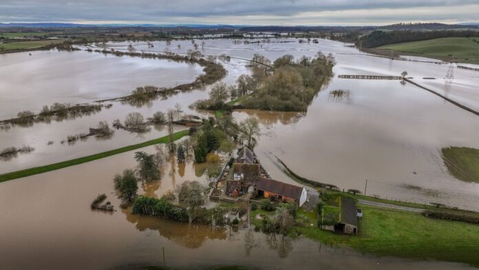
A powerful El Niño event developing across the Pacific Ocean could have major consequences for global weather, with forecasters warning that its combination with human-driven climate change may push global temperatures to unprecedented levels. The phenomenon could also influence rainfall, storms and other weather patterns across several parts of the world.
Highlights
- A major El Niño event is developing over the Pacific Ocean.
- The phenomenon could contribute to record global temperatures in 2027.
- India is already experiencing signs of altered monsoon patterns.
- The Atlantic hurricane season could be affected by El Niño conditions.
- The UK could face a wetter and stormier autumn.
Main Story
A Powerful Climate Pattern Takes Shape
Weather forecasters are raising concerns about an unusually strong El Niño developing in the Pacific Ocean, with the UK Met Office describing the signal in its forecasts as exceptionally intense.
El Niño is a naturally occurring climate pattern that develops when ocean temperatures in parts of the Pacific become unusually warm. Because the Pacific is so large, changes there can influence atmospheric conditions far beyond the region.
The current event is attracting particular attention because it is developing alongside long-term global warming.
Possible Impact on Global Temperatures
The Met Office has warned that the combination of a strong El Niño and human-induced climate change could make 2027 the hottest year ever recorded globally.
El Niño naturally raises global temperatures because heat stored in the tropical Pacific can be released into the atmosphere. When that occurs against a backdrop of an already warming planet, the resulting temperatures can become even more extreme.
Scientists are, however, still studying whether climate change itself is making El Niño events stronger. There is currently no clear evidence that global warming is directly increasing the intensity of the phenomenon.
Weather Patterns Already Showing Changes
The effects of El Niño can stretch across continents, changing rainfall and storm patterns in different parts of the world.
India has recorded signs of weaker-than-usual monsoon rainfall, while the Atlantic has experienced conditions that can reduce hurricane activity during some El Niño events.
The impacts are not identical everywhere. Some regions may experience heavier rainfall and flooding, while others can face drier conditions and increased heat.
What Could It Mean
For the UK, forecasters are watching for the possibility of a particularly unsettled autumn.
El Niño can influence atmospheric circulation over the North Atlantic and Europe, potentially creating conditions associated with wetter and stormier weather.
Long-range forecasts are already showing signs of an unsettled period, although predicting specific weather events months in advance remains uncertain.
El Niño typically occurs every two to seven years and generally lasts for several months to around a year.
Under normal conditions, trade winds move warm surface water from the eastern Pacific towards the west. During an El Niño event, those winds weaken or sometimes change direction, allowing warmer water to shift back towards the central and eastern Pacific.
That change affects the atmosphere above the ocean and can disrupt established weather patterns around the world.
A Warning for a Warming Planet
The biggest concern is not simply the strength of El Niño itself, but what happens when a naturally occurring climate cycle interacts with a warmer global climate.
Extreme heat, heavy rainfall, drought and powerful storms can all carry greater consequences when communities are already dealing with the effects of climate change.
For countries such as Kenya, where livelihoods and food security are closely linked to rainfall patterns, major shifts in global weather systems are worth watching closely.
As the planet continues to warm, the bigger question may not be whether extreme weather will happen, but how prepared we are when it does.

