
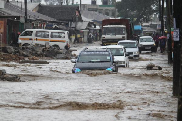
Kenya and countries around the world are being warned to prepare for an unusually powerful El Niño, with the World Meteorological Organization (WMO) giving the climate event an almost unprecedented level of certainty. The phenomenon is expected to remain in place through February 2027, with potential consequences ranging from floods and droughts to disruptions in agriculture, transport, food supplies and energy.
Highlights
- WMO puts the likelihood of El Niño continuing through February 2027 at nearly 100%.
- Pacific Ocean temperatures are already significantly above average.
- The event could become the strongest recorded since modern monitoring began.
- Agriculture, water, health, transport and energy could all be affected.
- WMO says early preparation could help prevent El Niño from becoming a disaster.
Main Story
WMO Sounds the Alarm
The world could be heading into an exceptionally powerful El Niño, according to the latest assessment from the World Meteorological Organization.
WMO forecasts are developed using information from global climate prediction centres, national meteorological agencies and climate experts. The latest projections put the probability of El Niño continuing until February 2027 at almost 100 per cent.
The organisation says this is an unusually high level of confidence and comes as the climate pattern becomes firmly established across the tropical Pacific.
Pacific Ocean Temperatures Rising
The warning is being driven largely by conditions beneath and on the surface of the Pacific Ocean.
Sea temperatures in the tropical Pacific are already considerably warmer than normal and continue to rise. Sub-surface temperatures have also reached exceptionally high levels, with some areas recording temperatures more than 8°C above average during July and early August.
That vast reservoir of warm water could provide additional energy for the weather phenomenon in the months ahead.
WMO says El Niño is expected to strengthen further and could reach exceptionally strong levels before reaching its peak towards the end of 2026.
If current trends continue, the event could potentially surpass anything observed during the four decades of modern monitoring.
What El Niño Means for Kenya
Although El Niño originates in the Pacific Ocean, its influence can extend across the globe.
For Kenya, the potential effects could include changes in rainfall patterns, flooding in some areas and dry conditions in others. These shifts can have a direct impact on farming, water availability, infrastructure and livelihoods.
Kenya has experienced the disruptive effects of extreme weather before, with drought and flooding affecting communities, agriculture and food security.
The country’s vulnerability is particularly important because many households depend directly on weather-sensitive activities such as farming and livestock keeping.
The Threat Goes Beyond Weather
The impact of a strong El Niño is not limited to rainfall.
WMO warns that major sectors including agriculture, fisheries, trade, healthcare, energy, transport, water management and disaster response could all experience disruptions.
Extreme weather events can also trigger knock-on effects across supply chains. Damage to roads and infrastructure, for example, can make it harder to transport food and other essential goods, while drought can reduce agricultural production and put pressure on water supplies.
Preparation Could Save Lives
Despite the warning, WMO says El Niño should not automatically translate into disaster.
The organisation argues that accurate seasonal forecasts give governments and communities valuable time to prepare for possible extreme weather.
That could mean strengthening flood preparedness, protecting critical infrastructure, planning for water shortages, supporting farmers with timely information and ensuring emergency services are ready before conditions deteriorate.
WMO Secretary-General Celeste Saulo has stressed that the forecasts provide an opportunity to act before the worst effects arrive.
The message is particularly important for countries such as Kenya, where limited resources can make recovery from major climate-related disasters difficult.
Why Early Warning Matters
The forecast also highlights the growing importance of early-warning systems.
Knowing where extreme rainfall, drought or other climate impacts are likely to occur can allow authorities to move vulnerable communities, protect crops and livestock, reinforce infrastructure and prepare health services.
The latest El Niño outlook therefore presents both a warning and an opportunity: the stronger the preparations before the event peaks, the greater the chance of limiting its human and economic cost.
El Niño may be a natural climate cycle, but how severely it affects Kenya could depend on one thing within human control: how early we choose to prepare.

